![]()
![]()
![]()
![]()
![]()
![]()
![]()
Iphone / IPad application for measuring surface, perimeter and distance.
 |
 |
 |
 |
 |
 View and download in Itunes.
Description
 |
A2+ is an application dedicated to the measurement of land area, perimeter and distance. The moderate grounds can be situated all over the world.
Multilingual: English, French, German, Spanish, Italian, Portuguese, Japanese. |
A2+ has 4 ways of functioning:
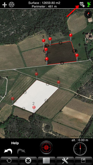
- GPS : The user is located on the field. He validates many points that best describe the ground through the position provided by GPS.
To enter a point just perform an action on the center red button.

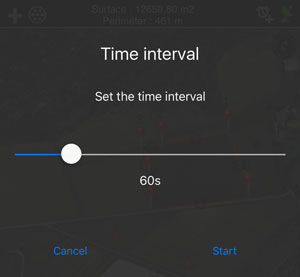
- GPS Auto : The user is located on the field. The application automatically takes the points with a regular time interval.
Just move yourself along the ground so that its outline is drawn. The time interval is adjustable from 5 to 120 seconds. The automatic mode can be stopped and restarted at any time.
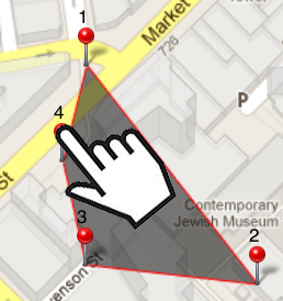
- Manual : the user entries points manually without moving by finding a way on the map.
For this, the user points his finger to enter the place for 1 second.
- Mixed : the user is entering the field and points via GPS and can be added manually (for example access difficult).
- Flexibility of A2+ -
Automatic recording of points with a regular time interval.
To activate the automatic mode, press the 'Timer' button at the top right of the screen.
Set the time interval with the cursor.
An action on the 'Start' button starts the recording of the points.
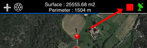
The flashing red symbol indicates that the automatic mode is in operation. In this mode, the number of points is limited to 200.
To stop the automatic mode, press the red symbol.
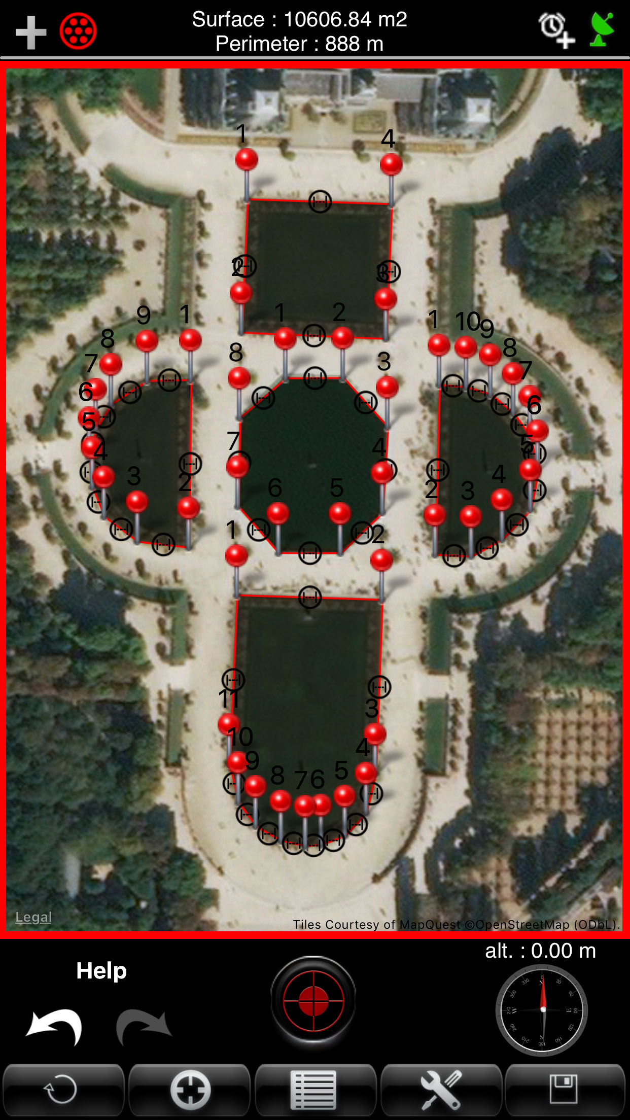
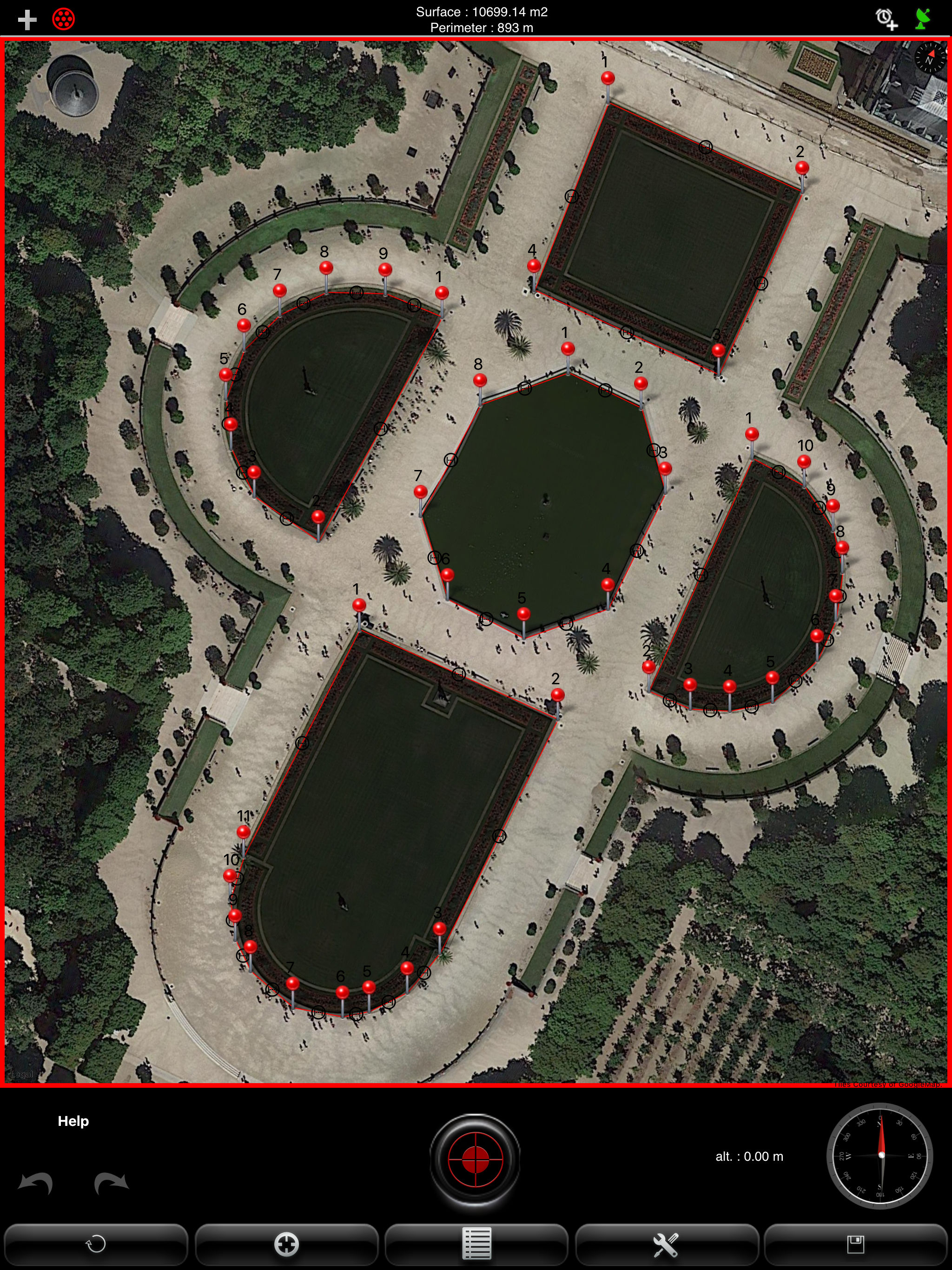
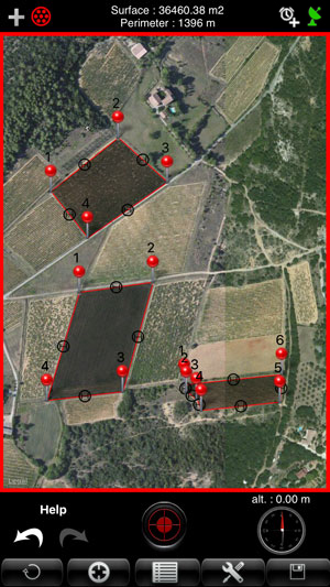
Measure of several surfaces on the same plan.
Since the version 4.3, it is possible to draw several surfaces on the same plan. Every plan can be selected, modified or deleted.
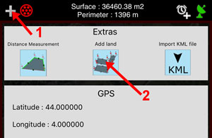
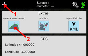
To add a surface, it is enough to press on the upper left button and to choose the option "Add land". The application returns on the page of mapping and you can draw the new surface.
To select all the grounds, it is enough to press on the button situated above on the left. The shown surface is the sum of quite surfaces. The same goes for the perimeter.
To select a single surface, it is enough to press on the desired surface.
To erase a surface, it is necessary to select her, then to press on the button "Erase".
IMPORTANT: to erase quite surfaces (and to begin a new plan), you have to select all the plans and use the button "Erase".
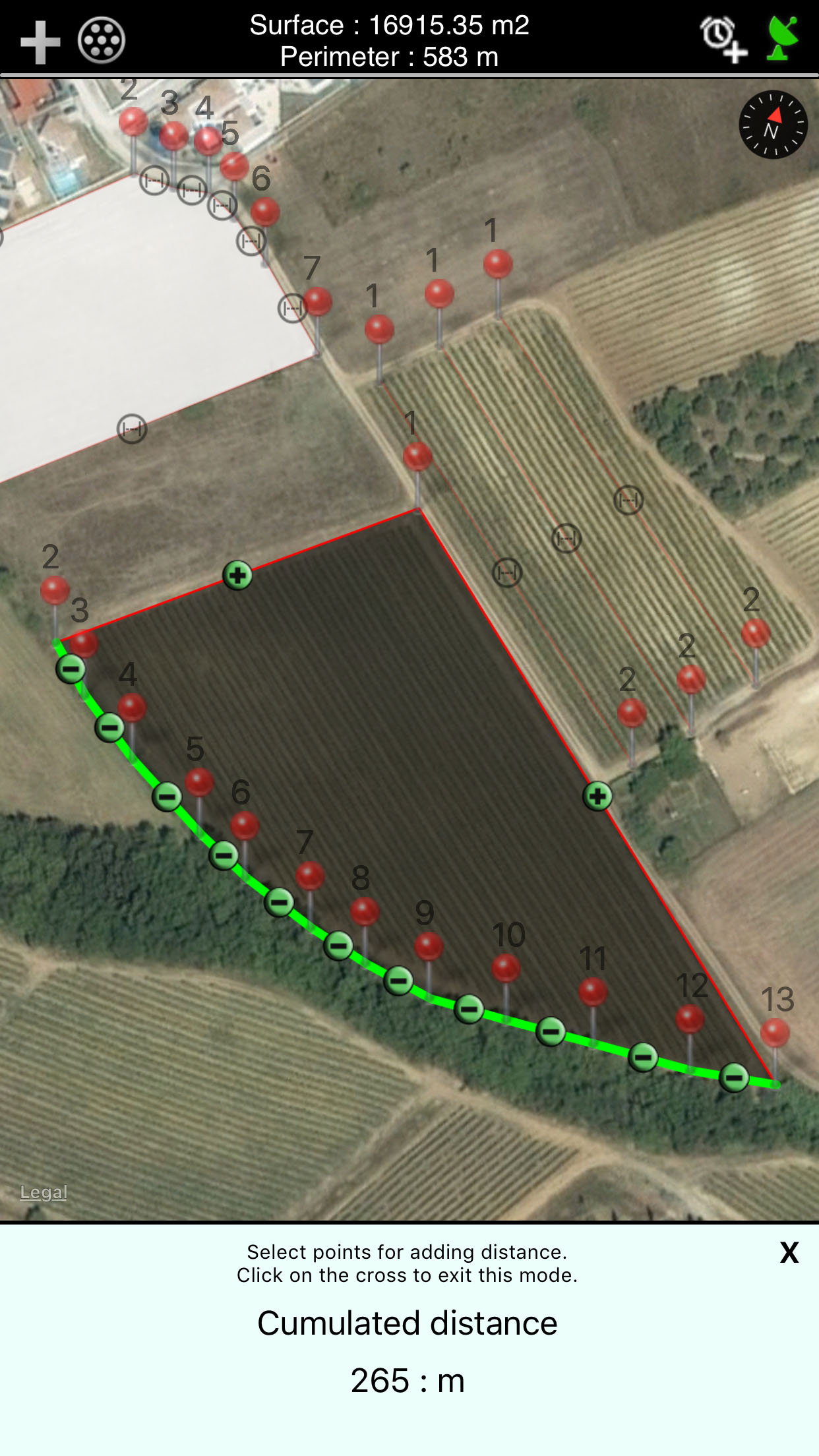
Measure of the accumulation of distance:
Since the version 4.3, it is possible to measure the accumulation of the distances composing the perimeter of a surface.
To use this mode on a surface, you have to select the desired surface then press on the upper left button then select " Distance Measurement".
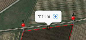
You can add a distance by pressing the button "more". The comul of the distances is posted at the bottom of the screen.

To go out of this mode, you have to press on the lower right cross.
- Viewing the perimeter and intermediate distances :
To display the distance between two points, simply press the black round symbol. The perimeter is permanently displayed at the top of the screen.
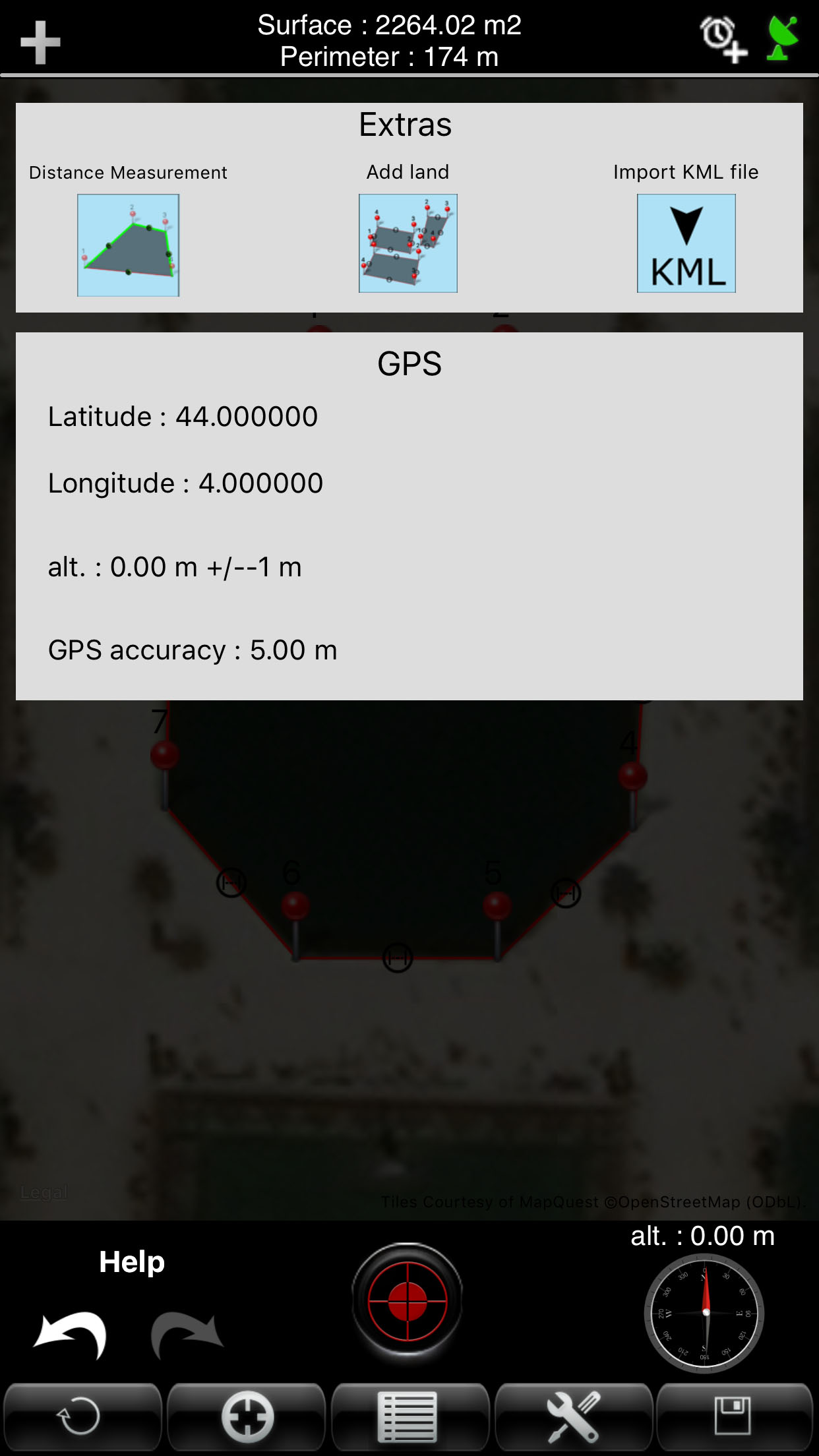
- Information on a point :
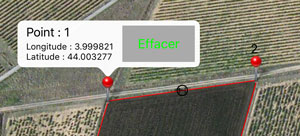
At any time, the user can know the coordinates of the points captured by briefly pressing with your finger the desired point.
- Moving a point :
Each input point can be moved with your finger to adjust its position.
For this, the user points his finger to move the point for 1 second. Just then move the marker to the new position.
- Deleting an entry point:
A point can be deleted individually by holding his finger to press the point, then the icon appears, press the "delete" button.
- Manually inserting a new point between two existing points:
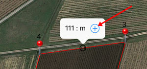
You can insert a new point between two existing points to refine the tracing of the plan. To insert a new point between two existing points, simply press the black icon, to display the distance between two points, and then press the icon "+". The new point is inserted in the middle of the two existing points. Just move your finger to adjust its position.
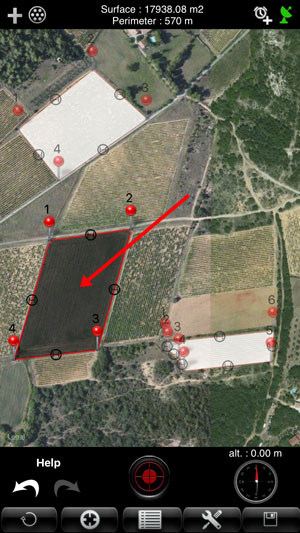
- Display of the surface :
The surface is calculated and displayed at each entry point again.
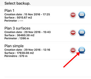
- Archiving of measures:
Each field measured can be archived with a custom name. Each record can be reopened and again be edited.
- GPS reception indicator :
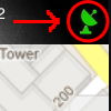
The icon at the top right corner of the application indicates the quality of GPS reception. Green indicates good reception, orange and red mean a poor reception.
- GPS Information :
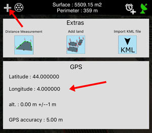
The "information" button will display the location information from GPS.
- Export plans in the format 'KML':
To export a plan with the format 'KML', you must go to the backup list and press the icon 'email'. A2+ adds, in the e-mail, the plan attached. You simply write the recipient and send the message.
Import KML file :
To import a plan with a KML file, you have to press on the upper left button and select "Import KML file".
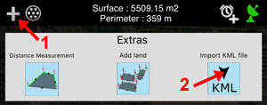
You have to inform the internet address of your file. You can use Dropbox, Google Drive or a personal server.
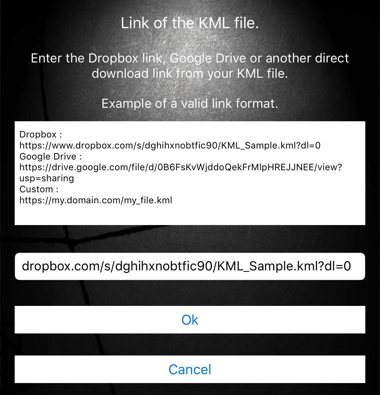
Once the import was made a success, the plan KML displays on the screen of mapping.
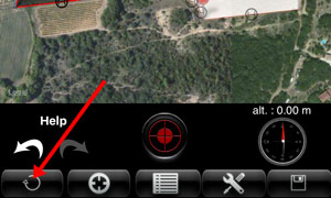
- Down menu :
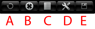
A - Erasing all points on a surface. If all surfaces are selected, the whole plane will be erased.
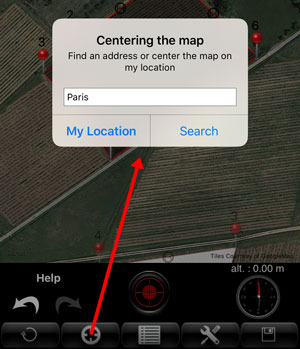
B - Center the map on the current position of the user or perform an address search.
C - Open backup.
D - Open menu option measure (see below).
E - Backup Plan.
- Options -
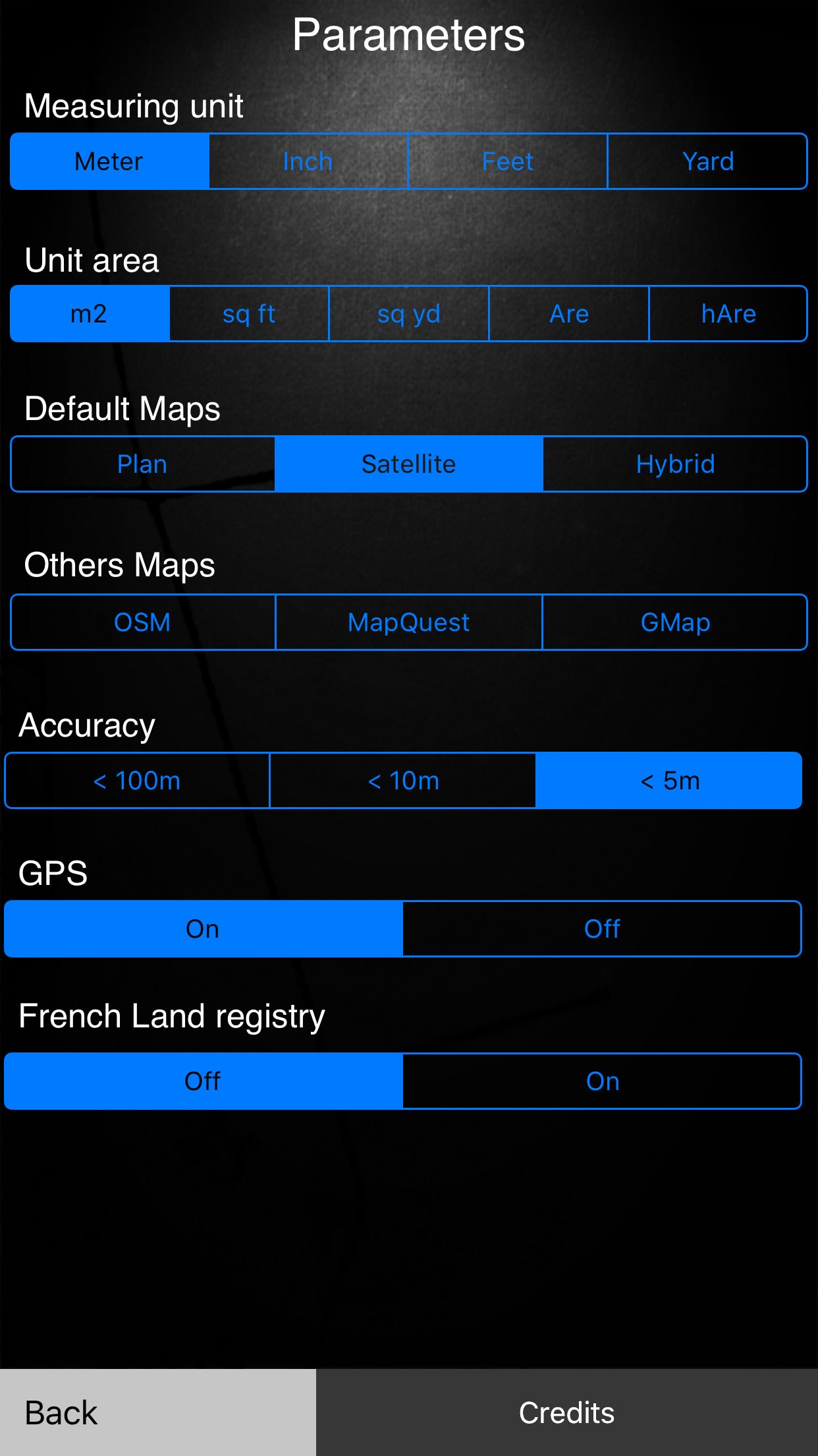
Several measurement options are available:
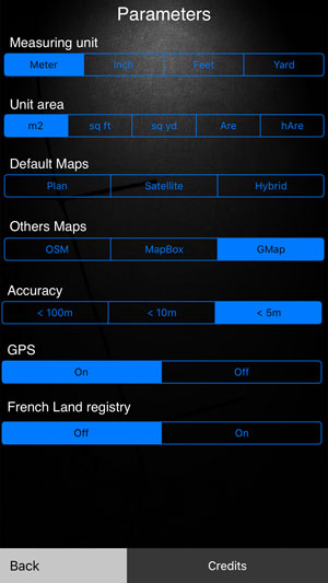
- Unit of measure: meter, inch, feet and yard.
- Surface unit : m2, square feet, square yard, are, ha.
- Map Type : Map, Satellite, hybrid (map + satellite).
- Other map : OSM, MapBox, Google Map.
- Accuracy in GPS mode : <100m, <10m, <5m.
This option will not allow to take a point if the GPS accuracy is below the setpoint.
- French Land registry
Design and Implementation.
![]()
Design and Realization of
Website
Application Iphone / Ipad / Android